U.A.I.R. Unmanned Aerial Imaging Resources LLC. provides professional aerial infrared thermal drone inspections for agricultural operations throughout Southern California.
Using advanced thermal imaging technology, our drone inspections help identify temperature differentials across crop fields that may indicate:
Irrigation inconsistencies
Water stress / low levels
Crop stress zones
Drainage issues
Soil moisture variations
Heat retention abnormalities
Potential equipment or irrigation line failures
Uneven field performance
Thermal aerial inspections provide farmers, growers, ranch operators, agricultural managers, and landowners with fast large-area visibility that can help support operational planning, irrigation management, and field condition awareness.
Flights are conducted using FAA-certified drone operations with a certified professional thermographer imaging capture and aerial reporting deliverables.
BASIC PACKAGE — Thermal Field Scan
Overview
Aerial infrared thermal survey designed to identify temperature variations across a field or large outdoor area. This service helps detect irrigation issues, crop stress, moisture inconsistencies, and potential infrastructure concerns.
ADVANCED PACKAGE — Thermal Analysis & Reporting
Overview
An advanced aerial thermal intelligence service that goes beyond standard infrared imaging. This package converts raw drone-captured thermal data into structured analysis, helping identify problem zones, environmental inefficiencies, and operational risks across agricultural or large field environments. It is designed for clients who need actionable insight, not just imagery.
PRO LARGE SCALE AGRICULTURE MONITORING PACKAGE
Best For:
Starting Rate – Custom quoted for large acreage projects.
Subscription/Monthly Monitoring Plans
Best for:
Soil Monitoring Plan
Crop Monitoring Plan
Soil + Crop + harvest Monitoring Plan
Tiered Acreage Pricing
Acreage Size & Rates
1–25 Acres - $ request quote
26–75 Acres - $ request quote
76–150 Acres - $ request quote
150+ Acres Custom Quote
This pricing model rewards larger acreage clients.
Optional Add-Ons
Repeat monitoring (weekly / monthly comparison)
3D terrain mapping integration
Priority response / rush delivery
Extended acreage coverage
Emergency drought inspections
RGB marketing imagery
Construction/land development scans
Solar infrastructure thermal inspections
Utility corridor inspections
Insurance documentation imagery
Custom reporting requests
DELIVERY METHODS
Client deliverables may be provided through:
Typical delivery:
24–72 hours depending on project size and reporting complexity
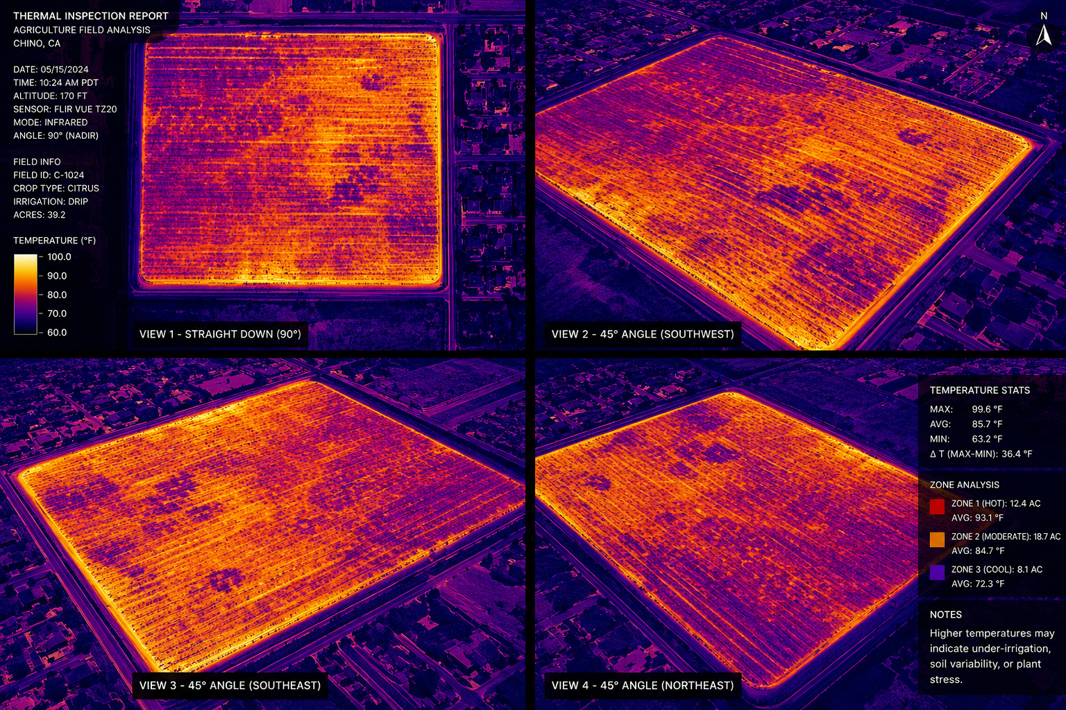 Image 1 of 7
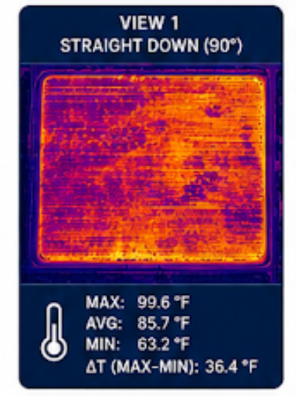 Image 2 of 7
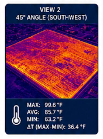 Image 3 of 7
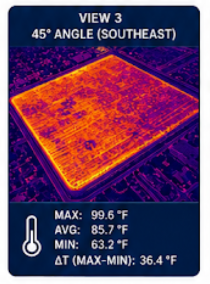 Image 4 of 7
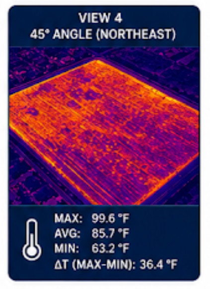 Image 5 of 7
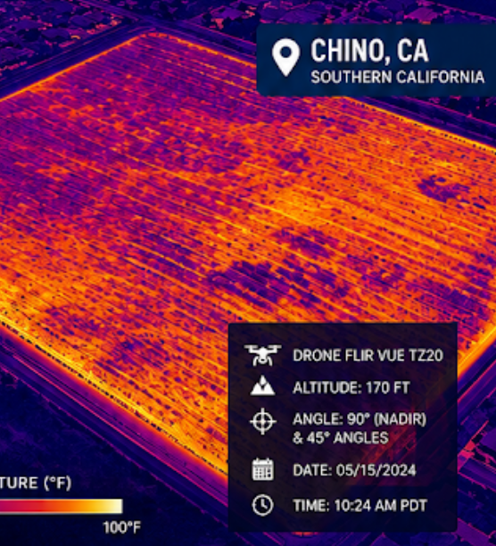 Image 6 of 7
 Image 7 of 7